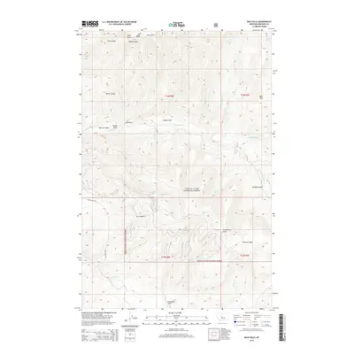
2014 Map of Bald Hills
USGS Topo · Published 2014About this map
Old Baldy rises prominently over this section of Meagher County, part of the high-elevation terrain within the Lewis & Clark National Forest. The landscape is defined by a dense network of gulches and coulees, including Bear Gulch, Lion Gulch, and Barrel Coulee, which channel water toward major drainages like Tenderfoot Cr. This 2014 survey documents the remote character of the Bald Hills region, where very few man-made landmarks exist beyond the winding path of Chris Aren Rd.
Find a feature on this map
67 named features on this map. Tap any name to fly to it.
Don’t see what you’re looking for? This feature index may not catch every label — zoom into the map to look around manually.
Map Details
Editions of this 2014 Bald Hills Map
This is the sole edition of this map. No revisions or reprints were ever made.
Other maps of this area

1886 · Great Falls
USGS Topo · 1:250,000

1886 · Fort Logan
USGS Topo · 1:250,000

1948 · White Sulphur Springs
USGS Topo · 1:250,000

1954 · Great Falls
USGS Topo · 1:250,000

1957 · Great Falls
USGS Topo · 1:250,000

1958 · White Sulphur Springs
USGS Topo · 1:250,000

1961 · White Sulphur Springs
USGS Topo · 1:250,000

1965 · White Sulphur Springs
USGS Topo · 1:250,000

1966 · Lingshire NE
USGS Topo · 1:24,000
1966 · Ellis Canyon
USGS Topo · 1:24,000