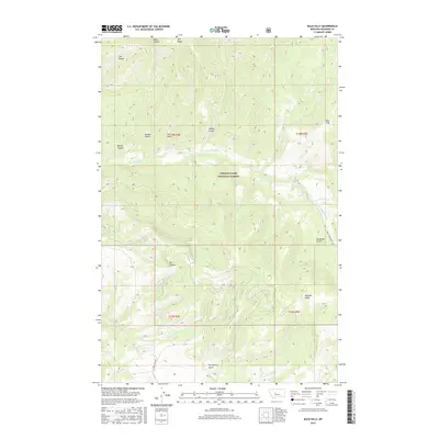
2017 Map of Bald Hills
USGS Topo · Published 2017About this map
Old Baldy stands as a prominent high point in this 2017 survey of the Big Belt Mountains region. The landscape is characterized by a complex drainage network that feeds into Tenderfoot Cr and its tributaries, including S Fork Tenderfoot Cr and Coyote Cr. Much of the territory falls within the protected boundaries of the Lewis & Clark National Forest, where the terrain transitions from steep ridges like Rimrock Ridge to deep drainages such as Deadman Gulch and Strawberry Gulch.
Find a feature on this map
31 named features on this map. Tap any name to fly to it.
Don’t see what you’re looking for? This feature index may not catch every label — zoom into the map to look around manually.
Map Details
Editions of this 2017 Bald Hills Map
This is the sole edition of this map. No revisions or reprints were ever made.
Other maps of this area

1886 · Great Falls
USGS Topo · 1:250,000

1886 · Fort Logan
USGS Topo · 1:250,000

1948 · White Sulphur Springs
USGS Topo · 1:250,000

1954 · Great Falls
USGS Topo · 1:250,000

1957 · Great Falls
USGS Topo · 1:250,000

1958 · White Sulphur Springs
USGS Topo · 1:250,000

1961 · White Sulphur Springs
USGS Topo · 1:250,000

1965 · White Sulphur Springs
USGS Topo · 1:250,000

1966 · Lingshire NE
USGS Topo · 1:24,000
1966 · Ellis Canyon
USGS Topo · 1:24,000