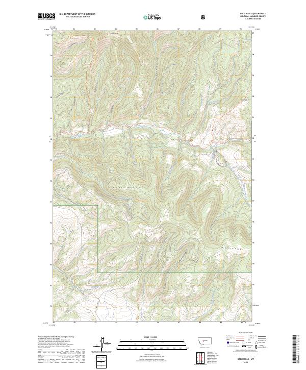
2024 Map of Bald Hills
USGS Topo · Published 2024About this map
Old Baldy and the Bald Hills define the high country of the Little Belt Mountains in this modern topographic study of Meagher County. The landscape is dominated by the protected acreage of the Lewis & Clark National Forest, where a network of primitive routes like the Cow Coulee Trl and Bald Hills Trl provide access to the drainages and ridges. The hydrology of the region is centered on Tenderfoot Creek and its various tributaries, including the South Fork Tenderfoot Creek and Miners Creek. Numerous topographic features such as Rimrock Ridge, Strawberry Gulch, and Deadman Gulch illustrate the complex verticality of this part of Montana. This contemporary survey reflects the enduring character of these mountain lands, showing the intersections of forest service boundaries and the continuing importance of managed forest infrastructure like S Fork Tenderfoot Rd.
Find a feature on this map
37 named features on this map. Tap any name to fly to it.
Don’t see what you’re looking for? This feature index may not catch every label — zoom into the map to look around manually.
Map Details
Editions of this 2024 Bald Hills Map
This is the sole edition of this map. No revisions or reprints were ever made.
Other maps of this area

1886 · Great Falls
USGS Topo · 1:250,000

1886 · Fort Logan
USGS Topo · 1:250,000

1948 · White Sulphur Springs
USGS Topo · 1:250,000

1954 · Great Falls
USGS Topo · 1:250,000

1957 · Great Falls
USGS Topo · 1:250,000

1958 · White Sulphur Springs
USGS Topo · 1:250,000

1961 · White Sulphur Springs
USGS Topo · 1:250,000

1965 · White Sulphur Springs
USGS Topo · 1:250,000

1966 · Lingshire NE
USGS Topo · 1:24,000
1966 · Ellis Canyon
USGS Topo · 1:24,000