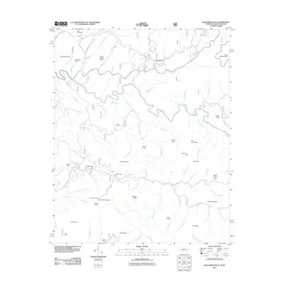
2011 Map of Bald River Falls
USGS Topo · Published 2011About this map
Waucheesi serves as a primary reference point in this high-elevation landscape, where the Waucheesi Fire Tower stands atop Waucheesi Mountain. The drainage system is defined by the Tellico River and its numerous tributaries, including the namesake Bald River Falls where the Bald River drops toward the main valley. The map documents a complex network of ridges and gaps, such as Canebrake Ridge and Mule Pen Gap, illustrating the difficult terrain that has historically shaped movement through this region.
Find a feature on this map
86 named features on this map. Tap any name to fly to it.
Don’t see what you’re looking for? This feature index may not catch every label — zoom into the map to look around manually.
Map Details
Editions of this 2011 Bald River Falls Map
This is the sole edition of this map. No revisions or reprints were ever made.
Other maps of this area

1893 · Murphy
USGS Topo · 1:125,000

1914 · Murphy
USGS Topo · 1:125,000

1927 · Big Junction
USGS Topo · 1:24,000

1933 · Haw Knob
USGS Topo · 1:48,000

1933 · Whiteoak Flats
USGS Topo · 1:24,000

1933 · Bald River Falls
USGS Topo · 1:24,000

1933 · Rafter
USGS Topo · 1:24,000

1934 · Mount Vernon
USGS Topo · 1:24,000

1934 · McDaniel Bald
USGS Topo · 1:24,000

1934 · Unaka
USGS Topo · 1:24,000