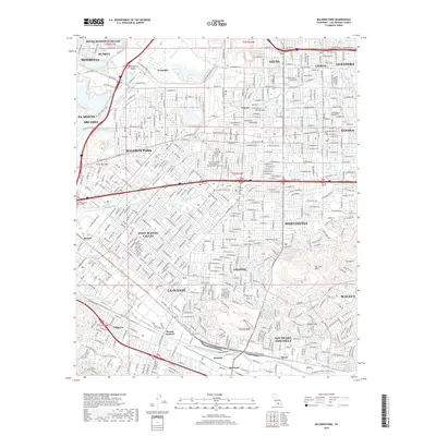
2018 Map of Baldwin Park
USGS Topo · Published 2018About this map
The San Gabriel River corridor anchors this modern study of the San Gabriel Valley, where dense residential development and industrial zones meet the foothills of the Puente Hills. The map details a complex hydrologic network, including the San Jose Creek Diversion Channel and numerous washes such as Little Dalton Wash and Sawpit Wash, reflecting the engineered water management of Los Angeles County. Local landmarks like Oakdale Cem and St John the Baptist Ch provide fixed points of reference for genealogists and local historians tracing the evolution of these suburban communities.
Find a feature on this map
94 named features on this map. Tap any name to fly to it.
Don’t see what you’re looking for? This feature index may not catch every label — zoom into the map to look around manually.
Map Details
Editions of this 2018 Baldwin Park Map
This is the sole edition of this map. No revisions or reprints were ever made.
Other maps of this area

1894 · Los Angeles
USGS Topo · 1:62,500

1894 · Pomona
USGS Topo · 1:62,500

1896 · Pasadena
USGS Topo · 1:62,500

1896 · Anaheim
USGS Topo · 1:62,500

1896 · Downey
USGS Topo · 1:62,500

1897 · Pomona
USGS Topo · 1:62,500

1898 · Pomona
USGS Topo · 1:62,500

1898 · Anaheim
USGS Topo · 1:62,500

1899 · Downey
USGS Topo · 1:62,500

1900 · Pasadena
USGS Topo · 1:62,500