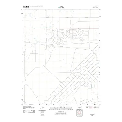
2010 Map of Baldy
USGS Topo · Published 2010About this map
Hansen Bluff rises on the western edge of this Alamosa County landscape, overlooking a transition from open terrain to a complex network of rural residential roads and transport lines. The 2010 survey illustrates a distinct land-use pattern where the Road 8 Railroad cuts across the center, acting as a northern boundary for a dense grid of named roads in the southeast, including Gardner Rd and Canon City Rd. To the north, the street layout becomes more typical of a developing suburban or rural subdivision, with names like Valley Vista Blvd and Turquoise Dr branching off County Rd-6-S. This map captures the area's growth and the integration of larger thoroughfares like County Hwy-116 with local access roads during the early 21st century.
Find a feature on this map
37 named features on this map. Tap any name to fly to it.
Don’t see what you’re looking for? This feature index may not catch every label — zoom into the map to look around manually.
Map Details
Editions of this 2010 Baldy Map
This is the sole edition of this map. No revisions or reprints were ever made.
Other maps of this area

1954 · Trinidad
USGS Topo · 1:250,000

1955 · Trinidad
USGS Topo · 1:250,000

1958 · Trinidad
USGS Topo · 1:250,000

1959 · Trinidad
USGS Topo · 1:250,000

1965 · Blanca
USGS Topo · 1:24,000

1965 · Baldy
USGS Topo · 1:24,000

1965 · Lasauses
USGS Topo · 1:24,000

1965 · Blanca SE
USGS Topo · 1:24,000

1965 · Dry Lakes
USGS Topo · 1:24,000

1965 · Twin Peaks
USGS Topo · 1:24,000