
1965 Map of Dry Lakes
USGS Topo · Published 1968About this map
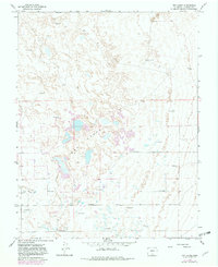
Dry Lakes dominate this San Luis Valley landscape, surrounded by an intricate hydrological network of artesian groundwater sources. Numerous points labeled Flowing Well and Flowing Wells are scattered throughout the terrain, particularly concentrated near the transition to the Sand Dunes in the northeastern quadrant. This pattern of surface water management is characteristic of the region's agricultural and pastoral history, where high water tables supported localized grazing and land use. Transportation through this part of Alamosa County is defined by a sparse grid of rural thoroughfares, including Fourmile Road and Central Lane, which provide the primary access to these low-lying areas. The map illustrates a high-desert environment where the presence of water is both essential and carefully noted, contrasting the arid dune formations with the persistent groundwater discharge that sustains the valley floor.
Find a feature on this map
8 named features on this map. Tap any name to fly to it.
Don’t see what you’re looking for? This feature index may not catch every label — zoom into the map to look around manually.
Map Details
Editions of this 1965 Dry Lakes Map
2 editions found
Other maps of this area

1954 · Trinidad
USGS Topo · 1:250,000

1955 · Trinidad
USGS Topo · 1:250,000

1958 · Trinidad
USGS Topo · 1:250,000

1959 · Trinidad
USGS Topo · 1:250,000

1965 · Medano Ranch
USGS Topo · 1:24,000

1965 · Blanca
USGS Topo · 1:24,000

1965 · Zapata Ranch
USGS Topo · 1:24,000

1965 · Baldy
USGS Topo · 1:24,000

1965 · Twin Peaks
USGS Topo · 1:24,000
1966 · Hooper SE
USGS Topo · 1:24,000