1965 Map of Dry Lakes
USGS Topo · Published 1982About this map
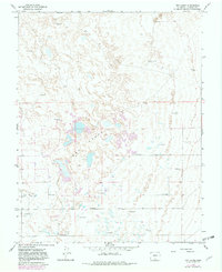
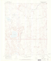
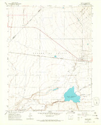
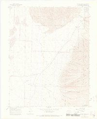
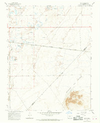
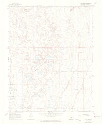
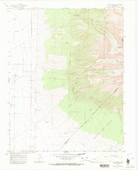
Dry Lakes dominate this San Luis Valley landscape, appearing as a network of shallow basins and ephemeral water bodies within the Alamosa region. This 1965 survey, updated in the early 1980s, reveals a terrain defined by high-altitude hydrologic management, characterized by numerous Flowing Wells scattered across the basin floor. These wells suggest a reliance on artesian water sources to support the area's sparse infrastructure.
Find a feature on this map
7 named features on this map. Tap any name to fly to it.
Don’t see what you’re looking for? This feature index may not catch every label — zoom into the map to look around manually.
Map Details
Editions of this 1965 Dry Lakes Map
2 editions found
Other maps of this area

1954 · Trinidad
USGS Topo · 1:250,000

1955 · Trinidad
USGS Topo · 1:250,000

1958 · Trinidad
USGS Topo · 1:250,000

1959 · Trinidad
USGS Topo · 1:250,000
1965 · Medano Ranch
USGS Topo · 1:24,000
1965 · Blanca
USGS Topo · 1:24,000
1965 · Zapata Ranch
USGS Topo · 1:24,000
1965 · Baldy
USGS Topo · 1:24,000
1965 · Dry Lakes
USGS Topo · 1:24,000
1965 · Twin Peaks
USGS Topo · 1:24,000