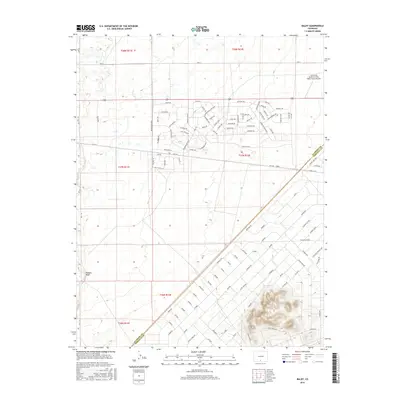
2016 Map of Baldy
USGS Topo · Published 2016About this map
Las Arenas Earth and Sky Observatory Airport anchors the northern portion of this high-desert landscape in the San Luis Valley, illustrating the intersection of aviation and science in this corner of Colorado. The area is defined by a dense, systematic grid of residential streets with evocative names such as Diamond Ave, Turquoise Dr, and Star Sapphire Ave, suggesting a planned development character typical of mid-century and later rural subdivisions in the Southwest. The Alamosa and Costilla County boundary line cuts diagonally across the southern terrain, where the topography shifts from flat basin floors to the rising elevation of Hansen Bluff. This transition in the land reveals the natural geological edges of the valley, contrasting with the rigid geometry of the road networks like Mountain View Blvd and Suburban Ave.
Find a feature on this map
149 named features on this map. Tap any name to fly to it.
Don’t see what you’re looking for? This feature index may not catch every label — zoom into the map to look around manually.
Map Details
Editions of this 2016 Baldy Map
This is the sole edition of this map. No revisions or reprints were ever made.
Other maps of this area

1954 · Trinidad
USGS Topo · 1:250,000

1955 · Trinidad
USGS Topo · 1:250,000

1958 · Trinidad
USGS Topo · 1:250,000

1959 · Trinidad
USGS Topo · 1:250,000

1965 · Blanca
USGS Topo · 1:24,000

1965 · Baldy
USGS Topo · 1:24,000

1965 · Lasauses
USGS Topo · 1:24,000

1965 · Blanca SE
USGS Topo · 1:24,000

1965 · Dry Lakes
USGS Topo · 1:24,000

1965 · Twin Peaks
USGS Topo · 1:24,000