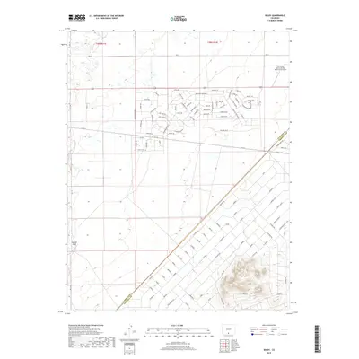
2019 Map of Baldy
USGS Topo · Published 2019About this map
Las Arenas Earth and Sky Observatory Airport anchors the northeastern portion of this High Plains landscape where Alamosa and Costilla counties meet. The grid-based settlement pattern is defined by a dense network of residential-style thoroughfares such as Valley Vista Blvd, Clearwater Blvd, and Skyway Dr, suggesting a planned development or large-scale subdivision. This geometric layout contrasts sharply with the natural landform of Hansen Bluff on the western edge of the quadrangle. Many of the streets follow wildlife and nature-based naming conventions, including Antelope Ave, Deer Run Blvd, and Badger Ave, while others like Lake View Blvd and Sunrise Blvd emphasize the intended character of the residential expansion in this part of the San Luis Valley.
Find a feature on this map
107 named features on this map. Tap any name to fly to it.
Don’t see what you’re looking for? This feature index may not catch every label — zoom into the map to look around manually.
Map Details
Editions of this 2019 Baldy Map
This is the sole edition of this map. No revisions or reprints were ever made.
Other maps of this area

1954 · Trinidad
USGS Topo · 1:250,000

1955 · Trinidad
USGS Topo · 1:250,000

1958 · Trinidad
USGS Topo · 1:250,000

1959 · Trinidad
USGS Topo · 1:250,000

1965 · Blanca
USGS Topo · 1:24,000

1965 · Baldy
USGS Topo · 1:24,000

1965 · Lasauses
USGS Topo · 1:24,000

1965 · Blanca SE
USGS Topo · 1:24,000

1965 · Dry Lakes
USGS Topo · 1:24,000

1965 · Twin Peaks
USGS Topo · 1:24,000