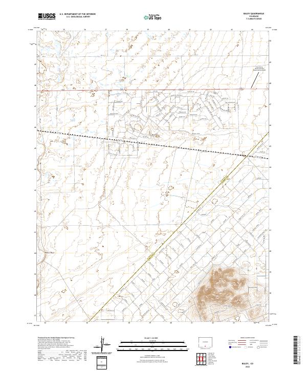
2022 Map of Baldy
USGS Topo · Published 2022About this map
The boundary between Alamosa Co Costilla Co cuts diagonally through this high-altitude landscape, where residential development patterns meet the open terrain of the San Luis Valley. In the northern reaches, a dense network of roads named for gemstones and local wildlife, such as Star Sapphire Ave, Badger Ave, and Peridot Dr, reveals a planned residential character. The Las Arenas Earth and Sky Observatory Airport sits on the eastern edge, taking advantage of the region's renowned clear skies. To the west, the topography is dominated by the prominent Hansen Bluff, while the southern portion of the sheet shows a more open, rural arrangement of land parcels across t36n r12e and t36n r11e.
Find a feature on this map
111 named features on this map. Tap any name to fly to it.
Don’t see what you’re looking for? This feature index may not catch every label — zoom into the map to look around manually.
Map Details
Editions of this 2022 Baldy Map
This is the sole edition of this map. No revisions or reprints were ever made.
Other maps of this area

1954 · Trinidad
USGS Topo · 1:250,000

1955 · Trinidad
USGS Topo · 1:250,000

1958 · Trinidad
USGS Topo · 1:250,000

1959 · Trinidad
USGS Topo · 1:250,000

1965 · Blanca
USGS Topo · 1:24,000

1965 · Baldy
USGS Topo · 1:24,000

1965 · Lasauses
USGS Topo · 1:24,000

1965 · Blanca SE
USGS Topo · 1:24,000

1965 · Dry Lakes
USGS Topo · 1:24,000

1965 · Twin Peaks
USGS Topo · 1:24,000