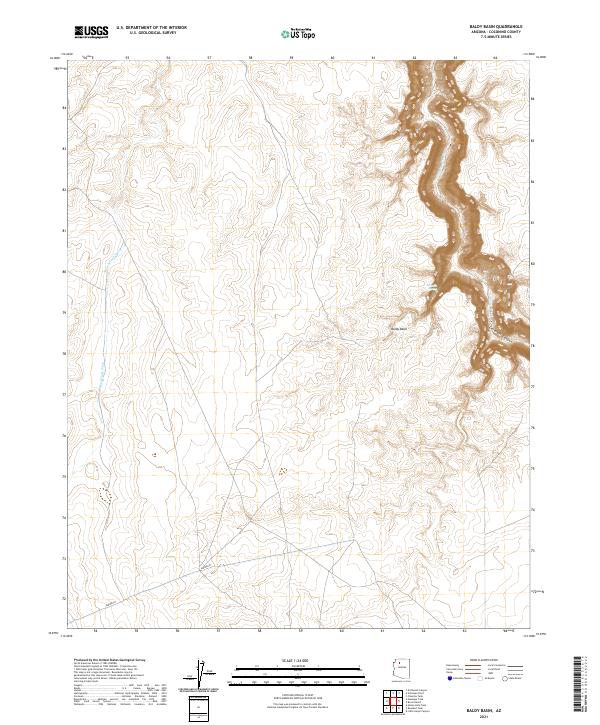
2021 Map of Baldy Basin
USGS Topo · Published 2021About this map
Cataract Canyon dominates the eastern edge of this Coconino County landscape, where the steep, winding walls of the canyon define the drainage of Cataract Creek. The terrain is characterized by a high desert plateau that drops sharply into these deep arterial gorges. Evidence of modern infrastructure is visible across the southern township lines, marked by a significant Aqueduct that cuts across the arid basin. Water sources are scarce in this environment, though Sinuelle Spring and seasonal drainages like Black Tank Wash provide critical points of interest in the otherwise dry Baldy Basin. The map illustrates a remote Arizona landscape where the natural geological features are the primary markers of location, with very little human development aside from the utility corridor.
Find a feature on this map
10 named features on this map. Tap any name to fly to it.
Don’t see what you’re looking for? This feature index may not catch every label — zoom into the map to look around manually.
Map Details
Editions of this 2021 Baldy Basin Map
This is the sole edition of this map. No revisions or reprints were ever made.
Other maps of this area

1886 · Chino
USGS Topo · 1:250,000

1886 · Kaibab
USGS Topo · 1:250,000

1891 · Chino
USGS Topo · 1:250,000

1948 · Williams
USGS Topo · 1:250,000

1953 · Grand Canyon
USGS Topo · 1:250,000

1954 · Williams
USGS Topo · 1:250,000

1956 · Williams
USGS Topo · 1:250,000

1957 · Grand Canyon
USGS Topo · 1:250,000

1958 · Grand Canyon
USGS Topo · 1:250,000

1960 · Williams
USGS Topo · 1:250,000