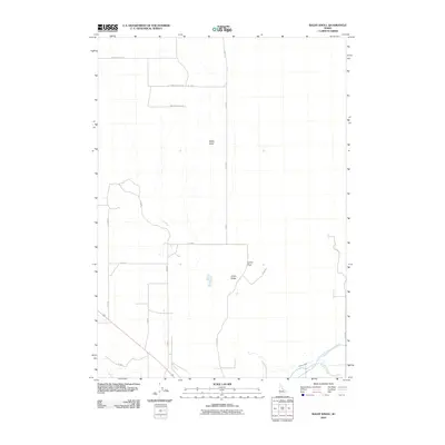
2010 Map of Baldy Knoll
USGS Topo · Published 2010About this map
Baldy Knoll and the surrounding terrain of Lemhi Ridge define the central topography of this Bingham County landscape. The area is characterized by a deliberate grid of rural roads, including Baldy Knoll Rd and the distinctive Baldy Knoll Loop, which trace the high ground and local ridges. This layout suggests a region organized for agriculture and livestock, where the terrain influences the transport network. Evidence of significant water management is found in the southeastern corner, where the Aberdeen Springfield Canal, Highline Ditch, and Peoples Canal provide the irrigation essential for farming in this part of Idaho. This network of canals and ditches reveals the human effort to transform the arid landscape into productive land, centered around landmarks like Lemhi Pass.
Find a feature on this map
18 named features on this map. Tap any name to fly to it.
Don’t see what you’re looking for? This feature index may not catch every label — zoom into the map to look around manually.
Map Details
Editions of this 2010 Baldy Knoll Map
This is the sole edition of this map. No revisions or reprints were ever made.
Other maps of this area

1940 · Blackfoot
USGS Topo · 1:62,500

1943 · Blackfoot
USGS Topo · 1:62,500

1955 · Baldy Knoll
USGS Topo · 1:24,000

1955 · Rockford
USGS Topo · 1:24,000

1955 · Rose
USGS Topo · 1:24,000

1955 · Idaho Falls
USGS Topo · 1:250,000

1958 · Idaho Falls
USGS Topo · 1:250,000
1964 · Morgans Pasture NE
USGS Topo · 1:24,000
1971 · Blackfoot
USGS Topo · 1:24,000
1971 · Moreland
USGS Topo · 1:24,000