
1955 Map of Baldy Knoll
USGS Topo · Published 1956About this map
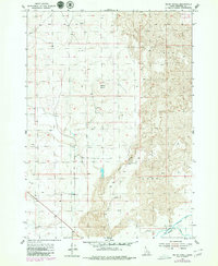
Baldy Knoll rises above a complex landscape where the volcanic history of Lava flows meets a highly engineered agricultural frontier. This 1950s survey documents a critical intersection of natural terrain and human reclamation, defined by the extensive irrigation network feeding the area near Moreland. Water management is the primary driver of development here, visible in the Aberdeen Canal, Springfield Canal, and the Peoples Ditch, which navigate the elevation changes alongside a siphon and the Highline. To the east, the volcanic fields are marked by Lemhi Ridge and the Lemhi Pass, showing the stark transition from the fertile irrigated lands to the desolate basaltic reaches. The map also records the Boise Base Line, providing an essential reference point for the grid of section lines that organized the settlement of Bingham County.
Find a feature on this map
14 named features on this map. Tap any name to fly to it.
Don’t see what you’re looking for? This feature index may not catch every label — zoom into the map to look around manually.
Map Details
Editions of this 1955 Baldy Knoll Map
2 editions found
Other maps of this area

1940 · Blackfoot
USGS Topo · 1:62,500

1943 · Blackfoot
USGS Topo · 1:62,500

1955 · Rockford
USGS Topo · 1:24,000

1955 · Rose
USGS Topo · 1:24,000

1955 · Idaho Falls
USGS Topo · 1:250,000

1958 · Idaho Falls
USGS Topo · 1:250,000
1964 · Morgans Pasture NE
USGS Topo · 1:24,000
1971 · Blackfoot
USGS Topo · 1:24,000
1971 · Moreland
USGS Topo · 1:24,000

1973 · Olsen
USGS Topo · 1:24,000