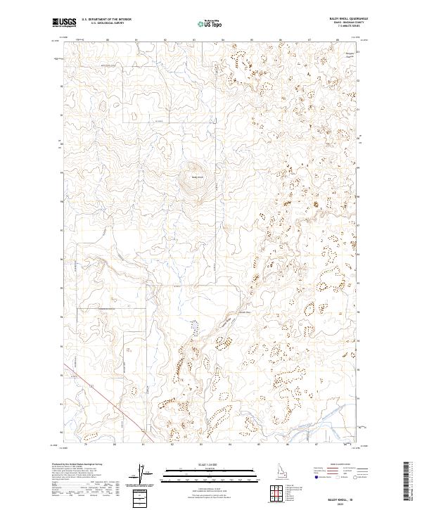
2023 Map of Baldy Knoll
USGS Topo · Published 2023About this map
Baldy Knoll rises above a landscape defined by organized irrigation and systematic land divisions in this 2023 survey of Bingham County. The southern portion of the sheet reveals the complex water management network essential to the region's agriculture, including the Aberdeen Springfield Canal, Peoples Canal, and the Highline Ditch. These waterways support the outlying areas of Morgans Pasture, where the desert terrain has been shaped into productive land through engineering.
Find a feature on this map
26 named features on this map. Tap any name to fly to it.
Don’t see what you’re looking for? This feature index may not catch every label — zoom into the map to look around manually.
Map Details
Editions of this 2023 Baldy Knoll Map
This is the sole edition of this map. No revisions or reprints were ever made.
Other maps of this area

1940 · Blackfoot
USGS Topo · 1:62,500

1943 · Blackfoot
USGS Topo · 1:62,500

1955 · Baldy Knoll
USGS Topo · 1:24,000

1955 · Rockford
USGS Topo · 1:24,000

1955 · Rose
USGS Topo · 1:24,000

1955 · Idaho Falls
USGS Topo · 1:250,000

1958 · Idaho Falls
USGS Topo · 1:250,000
1964 · Morgans Pasture NE
USGS Topo · 1:24,000
1971 · Blackfoot
USGS Topo · 1:24,000
1971 · Moreland
USGS Topo · 1:24,000