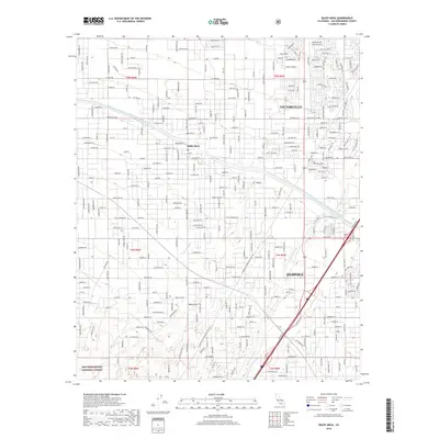
2018 Map of Baldy Mesa
USGS Topo · Published 2018About this map
Baldy Mesa serves as a prominent landform in this High Desert region, overlooking the urban expansion of Victorville and Hesperia in the late 2010s. The landscape is defined by the critical infrastructure of the Governor Edmund G Brown East Branch California Aqueduct, which winds through the northern and eastern portions of the map, illustrating the engineering required to support modern desert habitation. The southern reaches transition into the northern edges of the San Bernardino National Forest, where the terrain begins to rise toward the mountains. Evidence of early utility corridors is found in the LA Bureau of Power and Light Rd, while seasonal drainage patterns are clearly marked by the Oro Grande Wash and Manzanita Wash. The dense grid of residential streets such as Bear Valley Rd and Avenal St contrasts with the open spaces of the mesa.
Find a feature on this map
211 named features on this map. Tap any name to fly to it.
Don’t see what you’re looking for? This feature index may not catch every label — zoom into the map to look around manually.
Map Details
Editions of this 2018 Baldy Mesa Map
This is the sole edition of this map. No revisions or reprints were ever made.
Other maps of this area

1901 · Southern California Sheet No. 1
USGS Topo · 1:250,000

1902 · Hesperia
USGS Topo · 1:62,500

1903 · San Antonio
USGS Topo · 1:62,500

1904 · Southern California Sheet No. 1
USGS Topo · 1:250,000

1932 · Barstow
USGS Topo · 1:125,000

1934 · Barstow
USGS Topo · 1:125,000

1937 · Shadow Mountains
USGS Topo · 1:48,000
1942 · San Antonio
USGS Topo · 1:62,500

1942 · Hesperia
USGS Topo · 1:62,500

1942 · Shadow Mountains
USGS Topo · 1:62,500