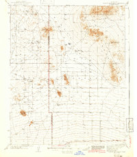
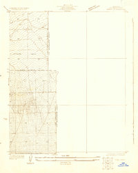
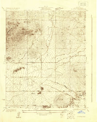
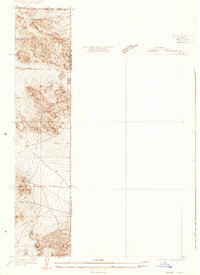
1942 Map of Shadow Mountains
USGS Topo · Published 1942About this map
The High Desert landscape of the Shadow Mountains is documented here during the early 1940s, revealing a sparse network of isolated ranching outposts and navigational aids. The border between Los Angeles Co and San Bernardino Co bisects the terrain, which is dominated by arid features such as the dry bed of Mirage Lake and several prominent peaks including Silver Peak and Adobe Mtn.
Find a feature on this map
19 named features on this map. Tap any name to fly to it.
Don’t see what you’re looking for? This feature index may not catch every label — zoom into the map to look around manually.
Map Details
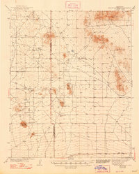
Editions of this 1942 Shadow Mountains Map
2 editions found
Other maps of this area

1901 · Southern California Sheet No. 1
USGS Topo · 1:250,000

1902 · Hesperia
USGS Topo · 1:62,500

1903 · Rock Creek
USGS Topo · 1:62,500

1903 · San Antonio
USGS Topo · 1:62,500

1904 · Southern California Sheet No. 1
USGS Topo · 1:250,000
1930 · Black Butte
USGS Topo · 1:24,000
1930 · El Mirage
USGS Topo · 1:24,000
1930 · Angle
USGS Topo · 1:24,000
1930 · Wilsona
USGS Topo · 1:24,000
1931 · Adobe
USGS Topo · 1:24,000