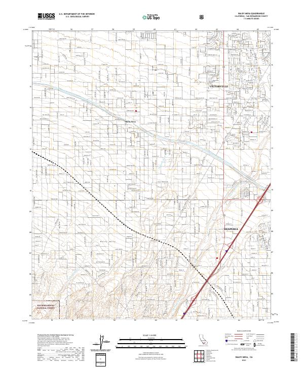
2021 Map of Baldy Mesa
USGS Topo · Published 2021About this map
Victorville and Hesperia anchor the eastern side of this High Desert landscape, where suburban residential expansion meets the northern foothills of the San Bernardino National Forest. The prominent landform of Baldy Mesa dominates the central portion of the sheet, characterized by a transition from a grid-based road network to the alluvial fans of the San Gabriel Mountains. Engineering infrastructure is central to the area's development, notably marked by the Governor Edmund G Brown East Branch California Aqueduct, which cuts across the northern half of the map. The drainage patterns of the Oro Grande Wash and Manzanita Wash illustrate the natural hydrology that historical planners had to navigate. This survey also records utility corridors like the La Bureau of Power and Light Rd, reflecting the regional power and water networks essential to San Bernardino County's growth.
Find a feature on this map
134 named features on this map. Tap any name to fly to it.
Don’t see what you’re looking for? This feature index may not catch every label — zoom into the map to look around manually.
Map Details
Editions of this 2021 Baldy Mesa Map
This is the sole edition of this map. No revisions or reprints were ever made.
Other maps of this area

1901 · Southern California Sheet No. 1
USGS Topo · 1:250,000

1902 · Hesperia
USGS Topo · 1:62,500

1903 · San Antonio
USGS Topo · 1:62,500

1904 · Southern California Sheet No. 1
USGS Topo · 1:250,000

1932 · Barstow
USGS Topo · 1:125,000

1934 · Barstow
USGS Topo · 1:125,000

1937 · Shadow Mountains
USGS Topo · 1:48,000
1942 · San Antonio
USGS Topo · 1:62,500

1942 · Hesperia
USGS Topo · 1:62,500

1942 · Shadow Mountains
USGS Topo · 1:62,500