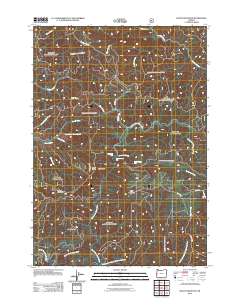
2011 Map of Baldy Mountain
USGS Topo · Published 2011About this map
North Fork Smith River and its complex network of tributaries dominate this 2011 survey of western Lane County. The drainage patterns of Kentucky Creek and Sweet Creek reveal a landscape defined by significant elevation changes, most notably at the triple-tiered descent of Upper Kentucky Falls, Lower Kentucky Falls, and North Fork Falls. These water features are surrounded by high terrain markers including Mount Grayback and the prominent Baldy Mountain. Forest access is traced through a system of timber and agency roads like Hadsall Creek Rd and BLM 19 Rd. The map provides a detailed view of the ridgelines that separate these watersheds, such as Smittie Ridge and Hand Ridge, which have long served as the primary landmarks for navigation through this heavily forested portion of the Coast Range.
Find a feature on this map
31 named features on this map. Tap any name to fly to it.
Don’t see what you’re looking for? This feature index may not catch every label — zoom into the map to look around manually.
Map Details
Editions of this 2011 Baldy Mountain Map
This is the sole edition of this map. No revisions or reprints were ever made.
Other maps of this area

1918 · Mapleton
USGS Topo · 1:48,000

1919 · Earl
USGS Topo · 1:48,000

1940 · Mapleton
USGS Topo · 1:62,500

1941 · Blachly
USGS Topo · 1:62,500

1942 · Blachly
USGS Topo · 1:62,500

1942 · Roman Nose Mtn
USGS Topo · 1:62,500

1943 · Goodwin Peak
USGS Topo · 1:62,500

1945 · Mapleton
USGS Topo · 1:62,500

1945 · Roman Nose Mtn
USGS Topo · 1:62,500

1953 · Salem
USGS Topo · 1:250,000