
1945 Map of Mapleton
USGS Topo · Published 1945About this map
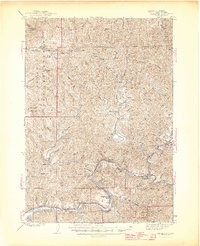
The Siuslaw River winds through the heart of the Siuslaw National Forest in this 1945 edition, which captures the coastal timber and ranching landscapes of Western Lane County. At the junction of river and rail, the town of Mapleton serves as a primary hub, while the Southern Pacific railroad follows the riverbank westward toward Beck Sta Tiernan PO. The map provides a detailed view of early 20th-century rural infrastructure, documenting isolated schoolhouses like Herman Sch and Minerva Sch that served remote drainage basins.
Find a feature on this map
63 named features on this map. Tap any name to fly to it.
Don’t see what you’re looking for? This feature index may not catch every label — zoom into the map to look around manually.
Map Details
Editions of this 1945 Mapleton Map
2 editions found
Other maps of this area

1918 · Mapleton
USGS Topo · 1:48,000

1919 · Earl
USGS Topo · 1:48,000

1920 · Siltcoos Lake
USGS Topo · 1:62,500

1920 · Heceta Head
USGS Topo · 1:62,500

1922 · Waldport
USGS Topo · 1:62,500

1940 · Mapleton
USGS Topo · 1:62,500

1941 · Blachly
USGS Topo · 1:62,500

1941 · Siltcoos Lake
USGS Topo · 1:62,500

1942 · Alsea
USGS Topo · 1:62,500

1942 · Blachly
USGS Topo · 1:62,500