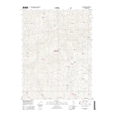
2015 Map of Ball Mountain
USGS Topo · Published 2015About this map
Mendocino National Forest defines the character of this interior California landscape, where complex ridges and drainages intersect. Remote homesteads and seasonal camps like Griffin Place and Peterson Place are the primary markers of human settlement in this high-elevation terrain. The map details a series of clearings known as glades, such as Hensley Glade, Kingsley Glade, and Sugarfoot Glade, which provide distinct breaks in the dense forest cover. Strategic landmarks such as Ball Mountain and Telephone Ridge rise above the deep cuts of Thomes Cr and Fish Cr. The presence of labels like Big Stump and Onion Springs suggests specific local history tied to timber harvesting and natural water sources, while the Trough Ridge-Forks Ridge route indicates the primary path through this backcountry in the mid-2010s.
Find a feature on this map
45 named features on this map. Tap any name to fly to it.
Don’t see what you’re looking for? This feature index may not catch every label — zoom into the map to look around manually.
Map Details
Editions of this 2015 Ball Mountain Map
This is the sole edition of this map. No revisions or reprints were ever made.
Other maps of this area

1890 · Red Bluff
USGS Topo · 1:250,000

1894 · Red Bluff
USGS Topo · 1:250,000

1949 · Colyear Springs
USGS Topo · 1:62,500

1952 · Paskenta
USGS Topo · 1:62,500

1952 · Anthony Peak
USGS Topo · 1:62,500

1954 · Yolla Bolly
USGS Topo · 1:62,500

1957 · Colyear Springs
USGS Topo · 1:62,500

1957 · Ukiah
USGS Topo · 1:250,000

1958 · Redding
USGS Topo · 1:250,000

1960 · Ukiah
USGS Topo · 1:250,000