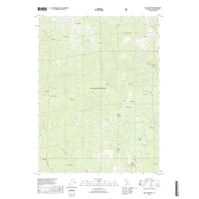
2018 Map of Ball Mountain
USGS Topo · Published 2018About this map
Mendocino National Forest defines this high-elevation landscape in Tehama County, where a complex network of ridges and glades creates a distinct topographic profile. The terrain is anchored by Ball Mtn and divided by prominent features like Boswell Ridge and South Ridge. Water sources are vital in this environment, with Thomes Cr and its tributaries such as Fish Cr and Snake Cr carving deep canyons through the uplift. The map reveals a history of land management and access through specialized routes like the Paskenta-Eel River road and the Trough Ridge-Forks Ridge trail system. Unique localized named areas like Kingsley Glade, Sugarfoot Glade, and Eury Glade suggest a landscape used for seasonal grazing or specific forest activities, while Onion Springs marks a key water point in the high country.
Find a feature on this map
48 named features on this map. Tap any name to fly to it.
Don’t see what you’re looking for? This feature index may not catch every label — zoom into the map to look around manually.
Map Details
Editions of this 2018 Ball Mountain Map
This is the sole edition of this map. No revisions or reprints were ever made.
Other maps of this area

1890 · Red Bluff
USGS Topo · 1:250,000

1894 · Red Bluff
USGS Topo · 1:250,000

1949 · Colyear Springs
USGS Topo · 1:62,500

1952 · Paskenta
USGS Topo · 1:62,500

1952 · Anthony Peak
USGS Topo · 1:62,500

1954 · Yolla Bolly
USGS Topo · 1:62,500

1957 · Colyear Springs
USGS Topo · 1:62,500

1957 · Ukiah
USGS Topo · 1:250,000

1958 · Redding
USGS Topo · 1:250,000

1960 · Ukiah
USGS Topo · 1:250,000