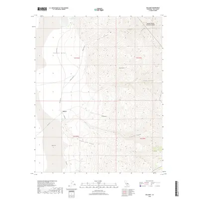
2018 Map of Ballarat
USGS Topo · Published 2018About this map
Ballarat sits as a lonely hub on the edge of the Panamint Valley in this modern topographical study, where the arid floor of the Mojave Desert meets the steep ascent into Death Valley National Park. The landscape is defined by deep incisions through the mountains, including Surprise Canyon, Happy Canyon, and Pleasant Canyon, each draining toward the expansive Alkali Flat.
Find a feature on this map
23 named features on this map. Tap any name to fly to it.
Don’t see what you’re looking for? This feature index may not catch every label — zoom into the map to look around manually.
Map Details
Editions of this 2018 Ballarat Map
This is the sole edition of this map. No revisions or reprints were ever made.
Other maps of this area

1908 · Ballarat
USGS Topo · 1:250,000

1913 · Ballarat
USGS Topo · 1:250,000

1915 · Searles Lake
USGS Topo · 1:250,000

1947 · Trona
USGS Topo · 1:250,000

1948 · Trona
USGS Topo · 1:250,000

1948 · Death Valley
USGS Topo · 1:250,000

1949 · Trona
USGS Topo · 1:62,500

1950 · Trona
USGS Topo · 1:62,500

1950 · Manly Peak
USGS Topo · 1:62,500
1951 · Manly Peak
USGS Topo · 1:62,500