
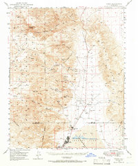
1949 Map of Trona
USGS Topo · Published 1958About this map
Trona serves as the industrial anchor for this mid-century desert landscape, situated at the edge of the mineral-rich Searles Lake and the vast Borax Flat. The 1949 field check reveals a community deeply integrated with the extraction economy, connected to the outside world via the Trona Railway and the Trona Airport. Beyond the processing centers, the Argus Range rises sharply, its canyons dotted with early mining operations such as the Mohawk Mine, Orendo Mine, and the Ruth Mine.
Find a feature on this map
61 named features on this map. Tap any name to fly to it.
Don’t see what you’re looking for? This feature index may not catch every label — zoom into the map to look around manually.
Map Details
Editions of this 1949 Trona Map
4 editions found
Other maps of this area

1908 · Ballarat
USGS Topo · 1:250,000

1913 · Ballarat
USGS Topo · 1:250,000

1915 · Searles Lake
USGS Topo · 1:250,000

1947 · Trona
USGS Topo · 1:250,000

1948 · Trona
USGS Topo · 1:250,000

1948 · Death Valley
USGS Topo · 1:250,000

1949 · Searles Lake
USGS Topo · 1:62,500

1950 · Searles Lake
USGS Topo · 1:62,500

1950 · Trona
USGS Topo · 1:62,500

1950 · Manly Peak
USGS Topo · 1:62,500