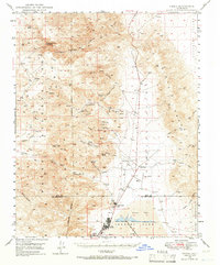
1949 Map of Trona
USGS Topo · Published 1966About this map
The industrial heart of the Mojave Desert is captured here through the lens of mineral extraction and water management. Trona sits at the edge of the mineral-rich dry bed of Searles Lake, where the Trona Pipe Line and infrastructure like Borax Flat point to the heavy chemistry and potash production that built this community. The map details the complex relationship between the settlement and its arid surroundings, tracing the essential network of desert water sources like Indian Joe Spring, Bainter Spring, and Quail Spr.
Find a feature on this map
57 named features on this map. Tap any name to fly to it.
Don’t see what you’re looking for? This feature index may not catch every label — zoom into the map to look around manually.
Map Details
Editions of this 1949 Trona Map
4 editions found
Other maps of this area

1908 · Ballarat
USGS Topo · 1:250,000

1913 · Ballarat
USGS Topo · 1:250,000

1915 · Searles Lake
USGS Topo · 1:250,000

1947 · Trona
USGS Topo · 1:250,000

1948 · Trona
USGS Topo · 1:250,000

1948 · Death Valley
USGS Topo · 1:250,000

1949 · Trona
USGS Topo · 1:62,500

1949 · Searles Lake
USGS Topo · 1:62,500

1950 · Searles Lake
USGS Topo · 1:62,500

1950 · Trona
USGS Topo · 1:62,500