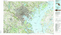
1984 Map of Baltimore
USGS Topo · Published 1984About this map
Baltimore anchors this mid-1980s landscape, illustrating a dense urban core radiating outward into industrial hubs and suburban expansions. The map highlights the city's strategic maritime position at the mouth of the Patapsco River, guarded by historical landmarks like Fort McHenry and Fort Carroll. Infrastructure of the era is prominently displayed, from the Francis Scott Key Bridge to the Baltimore-Washington Parkway and the sprawling Baltimore-Washington International Airport.
Find a feature on this map
323 named features on this map. Tap any name to fly to it.
Don’t see what you’re looking for? This feature index may not catch every label — zoom into the map to look around manually.
Map Details
Editions of this 1984 Baltimore Map
This is the sole edition of this map. No revisions or reprints were ever made.
Other maps of this area

1890 · Mt. Vernon
USGS Topo · 1:125,000

1891 · Mt. Vernon
USGS Topo · 1:125,000

1892 · Laurel
USGS Topo · 1:62,500

1892 · Ellicott
USGS Topo · 1:62,500

1892 · Owensville
USGS Topo · 1:62,500

1892 · Annapolis
USGS Topo · 1:62,500

1893 · North Point
USGS Topo · 1:62,500

1893 · Gunpowder
USGS Topo · 1:62,500

1893 · Frederick
USGS Topo · 1:125,000

1894 · Ellicott
USGS Topo · 1:62,500