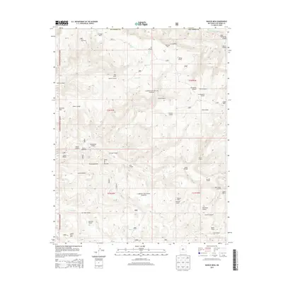
2013 Map of Bancos Mesa
USGS Topo · Published 2013About this map
Carson National Forest dominates this Rio Arriba County landscape, where the rugged canyon systems of northern New Mexico meet the waters of the San Juan River. The terrain is characterized by high plateau features like Carracas Mesa and Bancos Mesa, separated by a complex network of drainages including Alamo Canyon, Eul Canyon, and Wild Horse Canyon. This 2013 survey provides a detailed look at the rural ranching and resource-management infrastructure of the region, identifying remote outposts such as Gomez Ranch, Espinosa Ranch, and Bixler Ranch. The presence of numerous livestock-watering features like Log Tank, Chavez Tank, and Velasquez Spring indicates a land deeply tied to cattle and sheep grazing. This map captures the intersection of traditional land use and federal forest management in a high-desert environment defined by dramatic elevation changes between points like Eul Point and the deep floor of Cañon Bancos.
Find a feature on this map
59 named features on this map. Tap any name to fly to it.
Don’t see what you’re looking for? This feature index may not catch every label — zoom into the map to look around manually.
Map Details
Editions of this 2013 Bancos Mesa Map
This is the sole edition of this map. No revisions or reprints were ever made.
Other maps of this area

1889 · Largo
USGS Topo · 1:250,000

1895 · Largo
USGS Topo · 1:250,000

1924 · Pagosa Springs
USGS Topo · 1:125,000

1927 · Pagosa Springs
USGS Topo · 1:125,000

1945 · Durango
USGS Topo · 1:250,000

1953 · Durango
USGS Topo · 1:250,000

1954 · Durango
USGS Topo · 1:250,000

1954 · Allison
USGS Topo · 1:24,000

1954 · Carracas
USGS Topo · 1:24,000

1954 · Rosa
USGS Topo · 1:24,000