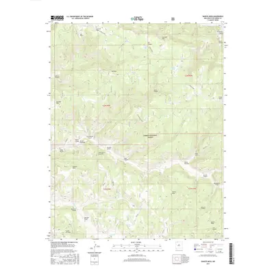
2017 Map of Bancos Mesa
USGS Topo · Published 2017About this map
Carson National Forest land defines this portion of Rio Arriba County, where the high desert plateau is carved into a complex system of mesas and deep drainage canyons. The topography is dominated by the massive Carracas Mesa in the north and Bancos Mesa to the southeast, separated by intricate networks of waterless draws like Eula Canyon and Orcones Canyon. This landscape of high benches, including Quintana Mesa and Anselmo Bench, reflects a remote environment where water management is critical for land use, as evidenced by the distribution of stock ponds such as Sanchez Tank, Alamo Tank, and Horse Tank.
Find a feature on this map
51 named features on this map. Tap any name to fly to it.
Don’t see what you’re looking for? This feature index may not catch every label — zoom into the map to look around manually.
Map Details
Editions of this 2017 Bancos Mesa Map
This is the sole edition of this map. No revisions or reprints were ever made.
Other maps of this area

1889 · Largo
USGS Topo · 1:250,000

1895 · Largo
USGS Topo · 1:250,000

1924 · Pagosa Springs
USGS Topo · 1:125,000

1927 · Pagosa Springs
USGS Topo · 1:125,000

1945 · Durango
USGS Topo · 1:250,000

1953 · Durango
USGS Topo · 1:250,000

1954 · Durango
USGS Topo · 1:250,000

1954 · Allison
USGS Topo · 1:24,000

1954 · Carracas
USGS Topo · 1:24,000

1954 · Rosa
USGS Topo · 1:24,000