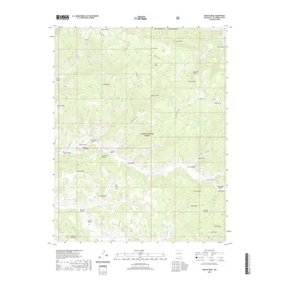
2020 Map of Bancos Mesa
USGS Topo · Published 2020About this map
Carson National Forest encompasses a significant portion of this landscape in northern Rio Arriba County, where high plateaus and complex drainage systems create a distinct topographical character. The terrain is defined by prominent landforms such as Bancos Mesa, Carracas Mesa, and Laguna Seca Mesa, which are separated by an intricate network of canyons including Wild Horse Canyon and Gurule Canyon. Water sources are sparse but critical, represented by the Velasquez Spring and the drainage of Cabresto Cr.
Find a feature on this map
48 named features on this map. Tap any name to fly to it.
Don’t see what you’re looking for? This feature index may not catch every label — zoom into the map to look around manually.
Map Details
Editions of this 2020 Bancos Mesa Map
This is the sole edition of this map. No revisions or reprints were ever made.
Other maps of this area

1889 · Largo
USGS Topo · 1:250,000

1895 · Largo
USGS Topo · 1:250,000

1924 · Pagosa Springs
USGS Topo · 1:125,000

1927 · Pagosa Springs
USGS Topo · 1:125,000

1945 · Durango
USGS Topo · 1:250,000

1953 · Durango
USGS Topo · 1:250,000

1954 · Durango
USGS Topo · 1:250,000

1954 · Allison
USGS Topo · 1:24,000

1954 · Carracas
USGS Topo · 1:24,000

1954 · Rosa
USGS Topo · 1:24,000