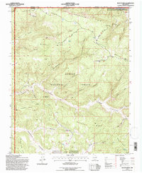
1995 Map of Bancos Mesa
USGS Topo · Published 1997About this map
Carson National Forest terrain dominates this New Mexico landscape, characterized by a series of high mesas and deep-cut canyons along the border with Colorado. The northern edge of the survey follows the Carracas Rim and the San Juan River, while the southern reaches are defined by Laguna Seca Mesa and Cabresto Canyon. Industrial activity is evident throughout the high ground, with numerous Gas Wells and a pipeline traversing the mesas, indicating the region's mid-century energy development. Natural water sources are scarce, marked primarily by livestock tanks like Sanchez Tank and Box Tank, alongside named springs such as Velásquez Spring. Distinctive landmarks like Pecho de la Doncella and Cedar Rock Lookout provide prominent orientation points across this drainage network of Cottonwood Canyon and Eula Canyon.
Find a feature on this map
44 named features on this map. Tap any name to fly to it.
Don’t see what you’re looking for? This feature index may not catch every label — zoom into the map to look around manually.
Map Details
Editions of this 1995 Bancos Mesa Map
This is the sole edition of this map. No revisions or reprints were ever made.
Other maps of this area

1889 · Largo
USGS Topo · 1:250,000

1895 · Largo
USGS Topo · 1:250,000

1924 · Pagosa Springs
USGS Topo · 1:125,000

1927 · Pagosa Springs
USGS Topo · 1:125,000

1945 · Durango
USGS Topo · 1:250,000

1953 · Durango
USGS Topo · 1:250,000

1954 · Durango
USGS Topo · 1:250,000

1954 · Allison
USGS Topo · 1:24,000

1954 · Carracas
USGS Topo · 1:24,000

1954 · Rosa
USGS Topo · 1:24,000