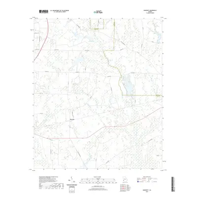
2020 Map of Bancroft
USGS Topo · Published 2020About this map
Bancroft serves as the central focal point of this Southwest Georgia landscape, where the boundary between Early and Calhoun counties meanders through a network of wetlands and agricultural drainage. The topography is defined by the winding course of Spring Creek and its various tributaries, including Number Seven Branch and Number Five Branch. A significant local landmark, Kolomoki Plantation Lake, sits in the northern portion of the map, illustrating the area's history of land management and water retention.
Find a feature on this map
38 named features on this map. Tap any name to fly to it.
Don’t see what you’re looking for? This feature index may not catch every label — zoom into the map to look around manually.
Map Details
Editions of this 2020 Bancroft Map
This is the sole edition of this map. No revisions or reprints were ever made.
Other maps of this area

1953 · Dothan
USGS Topo · 1:250,000

1954 · Dothan
USGS Topo · 1:250,000

1955 · Dothan
USGS Topo · 1:250,000

1973 · Blakely North
USGS Topo · 1:24,000

1973 · Bancroft
USGS Topo · 1:24,000

1973 · Blakely South
USGS Topo · 1:24,000

1973 · Edison
USGS Topo · 1:24,000
1973 · Bluffton
USGS Topo · 1:24,000
1973 · Zetto
USGS Topo · 1:24,000

1973 · Hentown
USGS Topo · 1:24,000