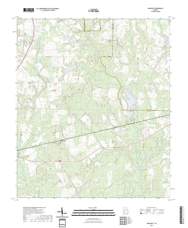
2024 Map of Bancroft
USGS Topo · Published 2024About this map
Bancroft and the surrounding agricultural lands of Early and Calhoun Counties are defined by a network of creeks and small family or church cemeteries. The landscape is primarily rural, with modern roads such as Peru Loop and Giles Hightower Rd weaving through timberlands and fields. Significant water features including Spring Creek, Perry Creek, and Kolomoki Plantation Lake dictate the local geography, while the presence of the Arms of Faith Missionary Baptist Church Cem and Christ Missionary Baptist Church Cem highlights the importance of historic rural congregations. The mapping of numbered tributaries like Number Seven Branch and Number Five Branch suggests a managed hydrologic system supporting the area's long-standing land use patterns. This 2024 data offers a contemporary record of these persistent small-community landmarks and rural property lines.
Find a feature on this map
44 named features on this map. Tap any name to fly to it.
Don’t see what you’re looking for? This feature index may not catch every label — zoom into the map to look around manually.
Map Details
Editions of this 2024 Bancroft Map
This is the sole edition of this map. No revisions or reprints were ever made.
Other maps of this area

1953 · Dothan
USGS Topo · 1:250,000

1954 · Dothan
USGS Topo · 1:250,000

1955 · Dothan
USGS Topo · 1:250,000

1973 · Blakely North
USGS Topo · 1:24,000

1973 · Bancroft
USGS Topo · 1:24,000

1973 · Blakely South
USGS Topo · 1:24,000

1973 · Edison
USGS Topo · 1:24,000
1973 · Bluffton
USGS Topo · 1:24,000
1973 · Zetto
USGS Topo · 1:24,000

1973 · Hentown
USGS Topo · 1:24,000