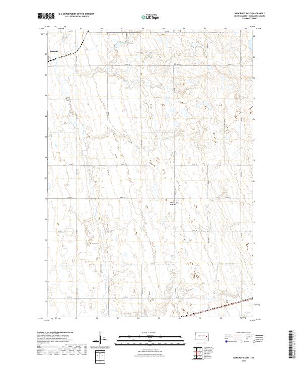
2021 Map of Bancroft East
USGS Topo · Published 2021About this map
The settlement of Bancroft sits at the northwestern edge of this landscape, situated upon the glacial highlands of the Coteau des Prairies. This high plateau region of Kingsbury County is defined by its rigorous section-line grid, where roads like 200th St and 426th Ave stretch across the prairie to connect isolated farmsteads. The drainage of the area is governed by the meandering Redstone Cr, which winds through the western townships, while Lake Agnew provides a rare permanent water feature in the northern sections. This 2021 survey demonstrates the enduring structure of South Dakota's agricultural heartland, where named avenues like Cottonwood Ave and Main Ave signify the localized centers of commerce and community in an otherwise vast, open terrain.
Find a feature on this map
26 named features on this map. Tap any name to fly to it.
Don’t see what you’re looking for? This feature index may not catch every label — zoom into the map to look around manually.
Map Details
Editions of this 2021 Bancroft East Map
This is the sole edition of this map. No revisions or reprints were ever made.
Other maps of this area

1899 · De Smet
USGS Topo · 1:125,000

1953 · Watertown
USGS Topo · 1:250,000

1958 · Watertown
USGS Topo · 1:250,000

1971 · Iroquois
USGS Topo · 1:24,000

1971 · Bancroft East
USGS Topo · 1:24,000

1971 · De Smet
USGS Topo · 1:24,000

1971 · Bancroft West
USGS Topo · 1:24,000

1971 · De Smet SE
USGS Topo · 1:24,000
1971 · Manchester
USGS Topo · 1:24,000

1973 · Carpenter SE
USGS Topo · 1:24,000
Featured Places
- Bancroft, SD
- Manchester Township, SD
- Le Sueur Township, SD
- Spirit Lake Township, SD
- Kingsbury County, SD