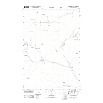
2011 Map of Bandbox Mountain
USGS Topo · Published 2011About this map
Old Yogo Townsite and Old Yogo Town anchor this rugged stretch of Judith Basin County, marking a landscape long defined by small-scale mineral extraction. The map reveals an extensive network of historic mining operations concentrated along the gulches and ridges, including the Gold Bug Mine and several sectional claims such as the SW SE Section 33 Mine. The terrain is characterized by prominent peaks like Bandbox Mountain and Gibson Peak, which overlook a complex drainage system including the North Fork Running Wolf Creek and Yogo Creek. This late-twentieth-century perspective shows how modern access via Running Wolf Rd and the Yogo Trl follows the old paths of prospectors through landmarks like Sixteen Color Gulch and Skunk Gulch, providing a detailed record for those tracing the mining history of the Little Belt Mountains region.
Find a feature on this map
44 named features on this map. Tap any name to fly to it.
Don’t see what you’re looking for? This feature index may not catch every label — zoom into the map to look around manually.
Map Details
Editions of this 2011 Bandbox Mountain Map
This is the sole edition of this map. No revisions or reprints were ever made.
Other maps of this area

1886 · Little Belt Mts.
USGS Topo · 1:250,000

1890 · Fort Benton
USGS Topo · 1:250,000

1892 · Fort Benton
USGS Topo · 1:250,000

1894 · Little Belt Mts.
USGS Topo · 1:250,000

1897 · Fort Benton
USGS Topo · 1:250,000

1897 · Little Belt Mts.
USGS Topo · 1:250,000

1898 · Little Belt Mts.
USGS Topo · 1:250,000

1902 · Little Belt Mts.
USGS Topo · 1:250,000

1948 · White Sulphur Springs
USGS Topo · 1:250,000

1954 · Great Falls
USGS Topo · 1:250,000