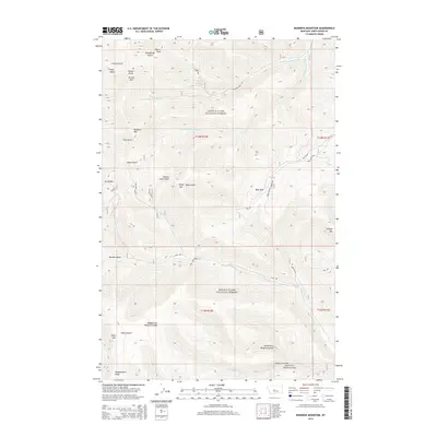
2014 Map of Bandbox Mountain
USGS Topo · Published 2014About this map
Old Yogo Town Ts sits within the high-altitude landscape of the Lewis & Clark National Forest, marking a site of historic significance in this portion of Montana. The terrain is defined by a series of prominent peaks and ridges, including Bandbox Mtn, Gibson Peak, and Kelly Mtn, which overlook a complex network of gulches and coulees. Waterways such as Yogo Cr and the north and south forks of Running Wolf Creek have carved deep into the mountainsides, shaping the physical geography that historical travelers navigated via the Yogo Trl. The map details various family-named and descriptive geographic features, from Rickard Coulee and Kelly Coulee to the broad expanse of Bear Park. This area of Judith Basin County remains characterized by its drainage systems and the high ridges of Tollgate Mtn and Woodchopper Ridge, providing a clear look at the topography of the Little Belt Mountains region.
Find a feature on this map
37 named features on this map. Tap any name to fly to it.
Don’t see what you’re looking for? This feature index may not catch every label — zoom into the map to look around manually.
Map Details
Editions of this 2014 Bandbox Mountain Map
This is the sole edition of this map. No revisions or reprints were ever made.
Other maps of this area

1886 · Little Belt Mts.
USGS Topo · 1:250,000

1890 · Fort Benton
USGS Topo · 1:250,000

1892 · Fort Benton
USGS Topo · 1:250,000

1894 · Little Belt Mts.
USGS Topo · 1:250,000

1897 · Fort Benton
USGS Topo · 1:250,000

1897 · Little Belt Mts.
USGS Topo · 1:250,000

1898 · Little Belt Mts.
USGS Topo · 1:250,000

1902 · Little Belt Mts.
USGS Topo · 1:250,000

1948 · White Sulphur Springs
USGS Topo · 1:250,000

1954 · Great Falls
USGS Topo · 1:250,000