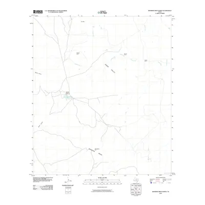
2010 Map of Bandera Mesa North
USGS Topo · Published 2010About this map
Bandera Mesa dominates the southern landscape of this Presidio County quadrangle, where the high desert terrain of the Big Bend region meets a network of seasonal watercourses and remote ranching outposts. This 2010 survey highlights a sparsely populated area defined by large landholdings such as Fowlkes Ranch, which features the Fowlkes Ranch Lake Dam and its namesake Fowlkes Ranch Lake. To the north, the elevation is punctuated by prominent landmarks like Needle Peak and the geological formation known as The Dike, while Green Valley stretches across the central portion of the sheet. Water is a defining but intermittent feature here, with drainage routes like Dogie Creek, Needle Creek, and Crystal Creek carving through the landscape. The inclusion of Smugglers Gap suggests the historical transit routes through these highlands, connecting isolated homesteads like Rooney Ranch and Cotters Ranch to the broader geography of West Texas.
Find a feature on this map
15 named features on this map. Tap any name to fly to it.
Don’t see what you’re looking for? This feature index may not catch every label — zoom into the map to look around manually.
Map Details
Editions of this 2010 Bandera Mesa North Map
This is the sole edition of this map. No revisions or reprints were ever made.
Other maps of this area

1917 · Agua Fria
USGS Topo · 1:62,500

1917 · Tascotal Mesa
USGS Topo · 1:62,500

1917 · Buck Hill
USGS Topo · 1:62,500

1918 · Buck Hill
USGS Topo · 1:62,500

1918 · Jordan Gap
USGS Topo · 1:62,500

1925 · Buck Hill
USGS Topo · 1:62,500

1930 · Jordan Gap
USGS Topo · 1:62,500

1937 · Agua Fria
USGS Topo · 1:62,500

1944 · Tascotal Mesa
USGS Topo · 1:62,500

1959 · Emory Peak
USGS Topo · 1:250,000