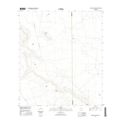
2016 Map of Bandera Mesa North
USGS Topo · Published 2016About this map
Bandera Mesa dominates the southern portion of this Big Bend country landscape, where the high desert floor is broken by dramatic geological formations like Needle Peak and the volcanic intrusion known as The Dike. In the central portion of the map, Smugglers Gap provides a notable passage through the elevated terrain, while the sparse water network of Dogie Cr, Needle Cr, and Crystal Cr drains toward the Green Valley at the Brewster County line. The presence of Fowlkes Ranch Lake and roads like Rancho Del Martillo Rd and Casapiedra Rd suggest the enduring importance of large-scale ranching operations in this isolated section of Presidio County. This 2016 survey documents a terrain defined by steep drainage systems such as Middle Canyon, South Canyon, and Point Draw, illustrating the complex topography of the Trans-Pecos region.
Find a feature on this map
15 named features on this map. Tap any name to fly to it.
Don’t see what you’re looking for? This feature index may not catch every label — zoom into the map to look around manually.
Map Details
Editions of this 2016 Bandera Mesa North Map
This is the sole edition of this map. No revisions or reprints were ever made.
Other maps of this area

1917 · Agua Fria
USGS Topo · 1:62,500

1917 · Tascotal Mesa
USGS Topo · 1:62,500

1917 · Buck Hill
USGS Topo · 1:62,500

1918 · Buck Hill
USGS Topo · 1:62,500

1918 · Jordan Gap
USGS Topo · 1:62,500

1925 · Buck Hill
USGS Topo · 1:62,500

1930 · Jordan Gap
USGS Topo · 1:62,500

1937 · Agua Fria
USGS Topo · 1:62,500

1944 · Tascotal Mesa
USGS Topo · 1:62,500

1959 · Emory Peak
USGS Topo · 1:250,000