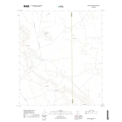
2019 Map of Bandera Mesa North
USGS Topo · Published 2019About this map
Bandera Mesa dominates this high-desert landscape along the border of Presidio and Brewster counties. The terrain is defined by dramatic elevation changes, from the prominent Needle Peak to the deep incisions of Middle Canyon and South Canyon. This 2019 survey reflects a sparsely populated ranching region where water is the primary geographic anchor, indicated by the presence of Fowlkes Ranch Lake and ephemeral drainages like Dogie Cr and Crystal Cr.
Find a feature on this map
15 named features on this map. Tap any name to fly to it.
Don’t see what you’re looking for? This feature index may not catch every label — zoom into the map to look around manually.
Map Details
Editions of this 2019 Bandera Mesa North Map
This is the sole edition of this map. No revisions or reprints were ever made.
Other maps of this area

1917 · Agua Fria
USGS Topo · 1:62,500

1917 · Tascotal Mesa
USGS Topo · 1:62,500

1917 · Buck Hill
USGS Topo · 1:62,500

1918 · Buck Hill
USGS Topo · 1:62,500

1918 · Jordan Gap
USGS Topo · 1:62,500

1925 · Buck Hill
USGS Topo · 1:62,500

1930 · Jordan Gap
USGS Topo · 1:62,500

1937 · Agua Fria
USGS Topo · 1:62,500

1944 · Tascotal Mesa
USGS Topo · 1:62,500

1959 · Emory Peak
USGS Topo · 1:250,000