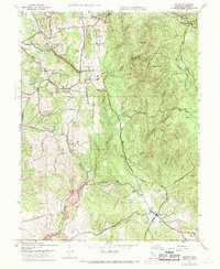
1947 Map of Bangor
USGS Topo · Published 1971About this map
Bangor and its surrounding Sierra Nevada foothills appear here during a period of agricultural and hydraulic transition in the late 1940s. The landscape is defined by an intricate network of water management features, including the Palermo Canal, the Bangor Ditch, and various siphons and flumes that diverted water through the rugged terrain. These systems, alongside the numerous ravines like Irish Ravine and Dutch Ravine, underscore the region's historical reliance on water for both mining and orchard cultivation.
Find a feature on this map
35 named features on this map. Tap any name to fly to it.
Don’t see what you’re looking for? This feature index may not catch every label — zoom into the map to look around manually.
Map Details
Editions of this 1947 Bangor Map
4 editions found
Other maps of this area

1888 · Marysville
USGS Topo · 1:125,000

1888 · Smartsville
USGS Topo · 1:125,000

1888 · Bidwell Bar
USGS Topo · 1:125,000

1891 · Bidwell Bar
USGS Topo · 1:125,000

1891 · Chico
USGS Topo · 1:125,000

1891 · Marysville
USGS Topo · 1:125,000

1891 · Smartsville
USGS Topo · 1:125,000

1892 · Smartsville
USGS Topo · 1:125,000

1893 · Chico
USGS Topo · 1:125,000

1893 · Bidwell Bar
USGS Topo · 1:125,000