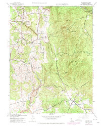
1947 Map of Bangor
USGS Topo · Published 1975About this map
Bangor and its surrounding foothills are documented here in a period of transition, reflecting both the legacy of the Gold Rush and modern water management. The landscape is defined by the complex drainage of the North Honcut Creek system, where numerous ravines like Irish Ravine and French Ravine slice through the terrain. Evidence of the region's industrial past is visible at the Phoenix Mine (Abandoned) and Blue Lead Mine (Abandoned), while long-established local identity is anchored by sites such as the Oak Grove Cem near Hurleton. The map also captures infrastructure for the California Department of Water Resources, including various Ditch and Siphon features that demonstrate the evolving utility of the land. From the residential clusters at Wyandotte to the higher elevations of Phoenix Hill and Rattlesnake Pt, this survey provides a comprehensive view of the Butte County interior during the mid-to-late 20th century.
Find a feature on this map
32 named features on this map. Tap any name to fly to it.
Don’t see what you’re looking for? This feature index may not catch every label — zoom into the map to look around manually.
Map Details
Editions of this 1947 Bangor Map
4 editions found
Other maps of this area

1888 · Marysville
USGS Topo · 1:125,000

1888 · Smartsville
USGS Topo · 1:125,000

1888 · Bidwell Bar
USGS Topo · 1:125,000

1891 · Bidwell Bar
USGS Topo · 1:125,000

1891 · Chico
USGS Topo · 1:125,000

1891 · Marysville
USGS Topo · 1:125,000

1891 · Smartsville
USGS Topo · 1:125,000

1892 · Smartsville
USGS Topo · 1:125,000

1893 · Chico
USGS Topo · 1:125,000

1893 · Bidwell Bar
USGS Topo · 1:125,000