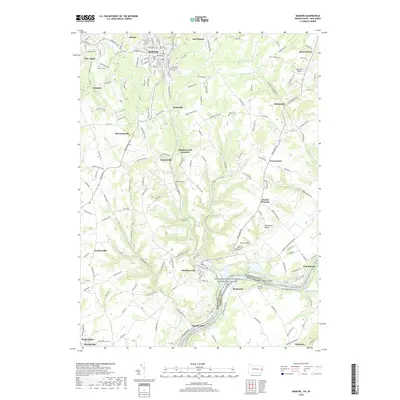
2019 Map of Bangor
USGS Topo · Published 2019About this map
Bangor and its surrounding borough-and-creek landscape define this portion of the Slate Belt in Northampton County. The terrain is deeply tied to the winding course of Martins Creek and its many tributaries, including Waltz Creek and Greenwalk Creek, which pass through a dense network of industrial-era settlements like Pen Argyl, Ackermanville, and Flicksville. The map captures the significant elevation changes leading toward Old Hound Ridge and the transition toward the river valley. To the south, the landscape opens at the Delaware River, where the protected corridor of the Lower Delaware Wild and Scenic River forms the state boundary with New Jersey. Transportation history is evident at the rail interface of Martins Creek Junction and the small aviation fields of Gap View Airport and Markle Airport.
Find a feature on this map
177 named features on this map. Tap any name to fly to it.
Don’t see what you’re looking for? This feature index may not catch every label — zoom into the map to look around manually.
Map Details
Editions of this 2019 Bangor Map
This is the sole edition of this map. No revisions or reprints were ever made.
Other maps of this area

1890 · Easton
USGS Topo · 1:62,500

1891 · Easton
USGS Topo · 1:62,500

1891 · Delaware Water Gap
USGS Topo · 1:62,500

1893 · Delaware Water Gap
USGS Topo · 1:62,500

1894 · Allentown
USGS Topo · 1:62,500

1914 · Wind Gap
USGS Topo · 1:62,500

1916 · Wind Gap
USGS Topo · 1:62,500

1932 · Easton
USGS Topo · 1:62,500

1936 · Delaware Water Gap
USGS Topo · 1:48,000

1939 · Allentown
USGS Topo · 1:62,500
Featured Places
- Bangor, PA
- Harmony Township, NJ
- Upper Mount Bethel Township, PA
- Ackermanville, Washington Township
- Martins Creek Junction, Washington Township