
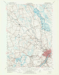
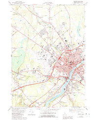
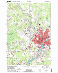
1948 Map of Bangor
USGS Topo · Published 1948About this map
Bangor and Brewer sit at the head of navigation on the Penobscot River, anchoring a postwar landscape defined by its deep estuaries and industrial river valleys. This mid-century survey captures the region as the Maine Central RR and Bangor & Aroostook RR networks remained vital for moving timber and textiles from interior towns like Waterville and Skowhegan to the coast. Along the fractured shoreline, the map details the complex geography of Penobscot Bay and Frenchman Bay, highlighting the prominence of Mount Desert Island and the established boundaries of Acadia National Park. The interior is a web of massive freshwater bodies such as Sebasticook Lake and Graham Lake, illustrating the glacial topography that shaped Maine's early settlement patterns and hydro-powered industries. From the granite heights of Mount Megunticook to the isolated outposts of Isle Au Haut, the sheet provides a comprehensive view of the Maine coast before modern highway expansion.
Find a feature on this map
67 named features on this map. Tap any name to fly to it.
Don’t see what you’re looking for? This feature index may not catch every label — zoom into the map to look around manually.
Map Details
Editions of this 1948 Bangor Map
This is the sole edition of this map. No revisions or reprints were ever made.
Historical Maps of Bog Corner Through Time
13 maps found
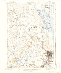
1902 Bangor
Penobscot County, ME

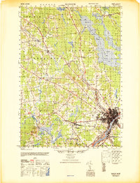
1942 Bangor
Penobscot County, ME
1946 Bangor
Penobscot County, ME
1948 Bangor
Penobscot County, ME
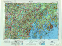
1955 Bangor
Penobscot County, ME
1956 Bangor
Penobscot County, ME

1960 Bangor
Penobscot County, ME

1961 Bangor
Penobscot County, ME
1978 Bangor
Penobscot County, ME

1985 Bangor
Penobscot County, ME

1994 Bangor
Penobscot County, ME
1996 Bangor
Penobscot County, ME
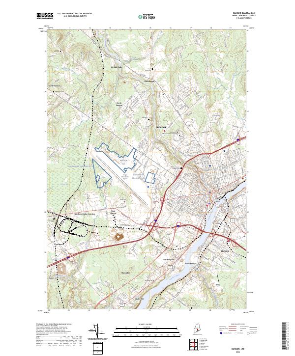
2024 Bangor
Penobscot County, ME