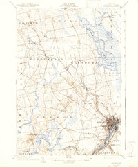
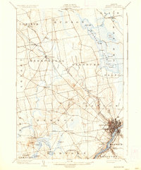
1902 Map of Bangor
USGS Topo · Published 1942About this map
Penobscot River commerce and industrial growth define this area at the turn of the century, where the city of Bangor serves as a major regional hub. The map reveals an intricate network of transportation, from the heavy tracks of the Maine Central R. R. and the Bucksport Br. to the local Electric R. R. connecting smaller settlements like Kenduskeag and Robyville. To the east, a dedicated Bicycle Path runs parallel to the river, signaling the era's recreational trends.
Find a feature on this map
65 named features on this map. Tap any name to fly to it.
Don’t see what you’re looking for? This feature index may not catch every label — zoom into the map to look around manually.
Map Details
Editions of this 1902 Bangor Map
6 editions found
Other maps of this area

1900 · Orland
USGS Topo · 1:62,500

1900 · Bucksport
USGS Topo · 1:62,500

1902 · Orono
USGS Topo · 1:62,500

1902 · Bucksport
USGS Topo · 1:62,500

1902 · Bangor
USGS Topo · 1:62,500

1917 · Passadumkeag
USGS Topo · 1:62,500

1931 · Stetson
USGS Topo · 1:48,000

1932 · Brooks
USGS Topo · 1:62,500

1932 · Dover-Foxcroft
USGS Topo · 1:48,000

1933 · Boyd Lake
USGS Topo · 1:62,500