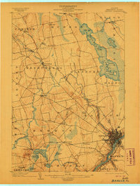
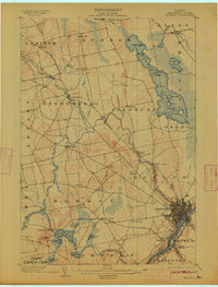
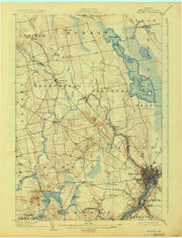
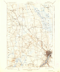
1902 Map of Bangor
USGS Topo · Published 1906About this map
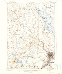
Bangor and Brewer serve as the industrial anchors of this early 20th-century landscape, positioned at the head of navigation on the Penobscot River. The map reveals a dense network of water-powered and rail-connected settlements, where the Maine Central R.R. and the Bucksport Br. link the river valley to the interior. Moving northwest from the city, the terrain transitions into a mosaic of small farming hamlets and crossings like Leather Corner and Snow Corner, punctuated by the steep rise of Hermon Hill.
Find a feature on this map
66 named features on this map. Tap any name to fly to it.
Don’t see what you’re looking for? This feature index may not catch every label — zoom into the map to look around manually.
Map Details
Editions of this 1902 Bangor Map
6 editions found
Other maps of this area

1900 · Orland
USGS Topo · 1:62,500

1900 · Bucksport
USGS Topo · 1:62,500

1902 · Orono
USGS Topo · 1:62,500

1902 · Bucksport
USGS Topo · 1:62,500

1902 · Bangor
USGS Topo · 1:62,500

1917 · Passadumkeag
USGS Topo · 1:62,500

1931 · Stetson
USGS Topo · 1:48,000

1932 · Brooks
USGS Topo · 1:62,500

1932 · Dover-Foxcroft
USGS Topo · 1:48,000

1933 · Boyd Lake
USGS Topo · 1:62,500