
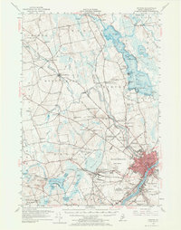
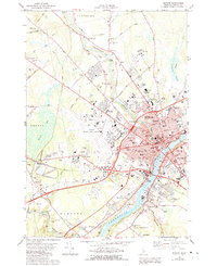
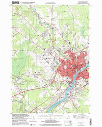
1961 Map of Bangor
USGS Topo · Published 1961About this map
The Penobscot River and Kennebec River basins dominate this mid-century portrait of Central and Coastal Maine, tracing the industrial and maritime corridors that shaped the region. From the logging and milling centers at Bangor, Old Town, and Brewer, the map follows the flow of commerce down to the granite and fishing ports of Rockland and Stonington. The landscape transitions from the agricultural valleys near Waterville and Augusta to the intricate, island-studded waters of Penobscot Bay. A prominent focus is Mount Desert Island, where Acadia National Park preserves the coastal heights above Bar Harbor. The transportation network is defined by the Maine Central and Bangor and Aroostook railroads, which linked the interior timberlands and lakeside settlements like Newport to the busy Atlantic harbors and Frenchman Bay.
Find a feature on this map
46 named features on this map. Tap any name to fly to it.
Don’t see what you’re looking for? This feature index may not catch every label — zoom into the map to look around manually.
Map Details
Editions of this 1961 Bangor Map
This is the sole edition of this map. No revisions or reprints were ever made.
Historical Maps of Hurd Corner Through Time
13 maps found
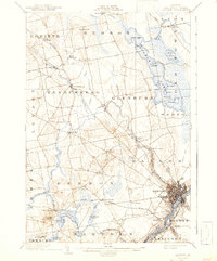
1902 Bangor
Penobscot County, ME

1942 Bangor
Penobscot County, ME
1946 Bangor
Penobscot County, ME

1948 Bangor
Penobscot County, ME
1955 Bangor
Penobscot County, ME
1956 Bangor
Penobscot County, ME

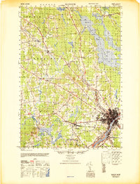
1960 Bangor
Penobscot County, ME
1961 Bangor
Penobscot County, ME
1978 Bangor
Penobscot County, ME

1985 Bangor
Penobscot County, ME

1994 Bangor
Penobscot County, ME
1996 Bangor
Penobscot County, ME
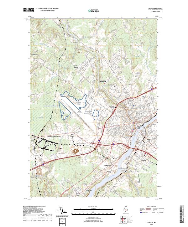
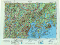
2024 Bangor
Penobscot County, ME