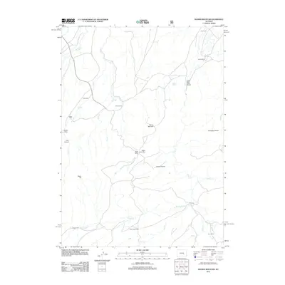
2012 Map of Banner Mountain
USGS Topo · Published 2012About this map
Banner Mountain dominates this portion of the Laramie Range in central Wyoming, serving as a landmark for a network of isolated homesteads and high-altitude pastures. The landscape is defined by its drainages, including Deer Cr and Negro Cr, which have carved out notable features such as Lower Deer Creek Canyon and Hess Draw. These water sources support a series of legacy operations, including the Smith Ranch and Kimball Ranch in the north, and Davis Ranch further south.
Find a feature on this map
32 named features on this map. Tap any name to fly to it.
Don’t see what you’re looking for? This feature index may not catch every label — zoom into the map to look around manually.
Map Details
Editions of this 2012 Banner Mountain Map
This is the sole edition of this map. No revisions or reprints were ever made.
Other maps of this area

1949 · Brookhurst
USGS Topo · 1:24,000

1949 · Parkerton
USGS Topo · 1:24,000

1950 · Lockett
USGS Topo · 1:24,000

1950 · Brookhurst
USGS Topo · 1:24,000

1950 · Parkerton
USGS Topo · 1:24,000

1954 · Torrington
USGS Topo · 1:250,000

1955 · Casper
USGS Topo · 1:250,000

1958 · Casper
USGS Topo · 1:250,000

1958 · Torrington
USGS Topo · 1:250,000

1960 · Ice Cave Mountain
USGS Topo · 1:24,000