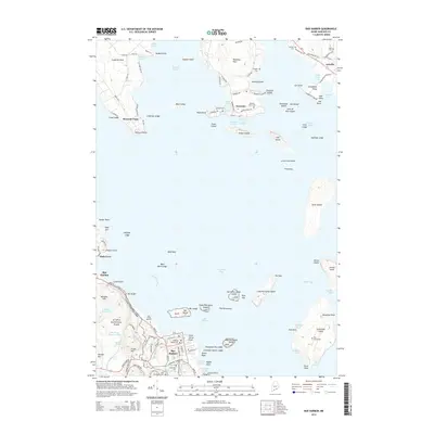
2014 Map of Bar Harbor
USGS Topo · Published 2014About this map
Acadia National Park dominates the western coastline of this survey, where the granite peaks and glacial ponds of Mount Desert Island meet the waters of Frenchman Bay. The town of Bar Harbor serves as a hub for the region, showing a dense network of streets like Eden St and Prospect Ave alongside cultural landmarks such as the Coll of the Atlantic. Genealogists will find a high concentration of burial sites, including Ledgelawn Cem and the Meeting House Cem, which document the long-standing community presence on the island.
Find a feature on this map
138 named features on this map. Tap any name to fly to it.
Don’t see what you’re looking for? This feature index may not catch every label — zoom into the map to look around manually.
Map Details
Editions of this 2014 Bar Harbor Map
This is the sole edition of this map. No revisions or reprints were ever made.
Other maps of this area

1904 · Mount Desert
USGS Topo · 1:62,500

1904 · Bar Harbor
USGS Topo · 1:62,500

1911 · Ellsworth
USGS Topo · 1:62,500

1930 · Tunk Lake
USGS Topo · 1:48,000

1932 · Tunk Lake
USGS Topo · 1:62,500

1940 · Ellsworth
USGS Topo · 1:62,500

1942 · Bar Harbor
USGS Topo · 1:62,500

1942 · Ellsworth
USGS Topo · 1:62,500

1942 · Mount Desert
USGS Topo · 1:62,500

1942 · Tunk Lake
USGS Topo · 1:62,500