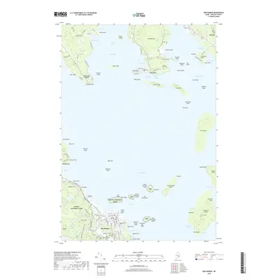
2018 Map of Bar Harbor
USGS Topo · Published 2018About this map
Acadia National Park dominates the southern landscape, where the rugged coast meets the elevations of Paradise Hill and Kebo Mtn. This coastal survey reveals the intricate geography of Frenchman Bay, an area defined by its deep harbors and numerous islands such as Stave Island and Jordan Island. The settlement of Bar Harbor is depicted with its dense street grid, serving as a gateway to the park and the College of the Atlantic.
Find a feature on this map
124 named features on this map. Tap any name to fly to it.
Don’t see what you’re looking for? This feature index may not catch every label — zoom into the map to look around manually.
Map Details
Editions of this 2018 Bar Harbor Map
This is the sole edition of this map. No revisions or reprints were ever made.
Other maps of this area

1904 · Mount Desert
USGS Topo · 1:62,500

1904 · Bar Harbor
USGS Topo · 1:62,500

1911 · Ellsworth
USGS Topo · 1:62,500

1930 · Tunk Lake
USGS Topo · 1:48,000

1932 · Tunk Lake
USGS Topo · 1:62,500

1940 · Ellsworth
USGS Topo · 1:62,500

1942 · Bar Harbor
USGS Topo · 1:62,500

1942 · Ellsworth
USGS Topo · 1:62,500

1942 · Mount Desert
USGS Topo · 1:62,500

1942 · Tunk Lake
USGS Topo · 1:62,500