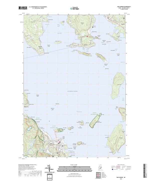
2024 Map of Bar Harbor
USGS Topo · Published 2024About this map
Acadia National Park dominates the southern reaches of this landscape, where the granite peaks of Kebo Mtn and Paradise Hill overlook the coastline. The rugged shoreline is defined by the deep waters of Frenchman Bay, which separates the bustling center of Bar Harbor from the quieter peninsulas of Crabtree Neck and Waukeag Neck. This coastal geography created a natural harbor system that supported both maritime trade and the early development of summer colonies in towns like Sorrento and Hancock Point.
Find a feature on this map
141 named features on this map. Tap any name to fly to it.
Don’t see what you’re looking for? This feature index may not catch every label — zoom into the map to look around manually.
Map Details
Editions of this 2024 Bar Harbor Map
This is the sole edition of this map. No revisions or reprints were ever made.
Other maps of this area

1904 · Mount Desert
USGS Topo · 1:62,500

1904 · Bar Harbor
USGS Topo · 1:62,500

1911 · Ellsworth
USGS Topo · 1:62,500

1930 · Tunk Lake
USGS Topo · 1:48,000

1932 · Tunk Lake
USGS Topo · 1:62,500

1940 · Ellsworth
USGS Topo · 1:62,500

1942 · Bar Harbor
USGS Topo · 1:62,500

1942 · Ellsworth
USGS Topo · 1:62,500

1942 · Mount Desert
USGS Topo · 1:62,500

1942 · Tunk Lake
USGS Topo · 1:62,500