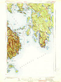
1942 Map of Bar Harbor
USGS Topo · Published 1942About this map
Acadia National Park and the rugged coastal communities of Hancock County are captured here during the early war years, showcasing a landscape of granite peaks and seafaring villages. On Mount Desert Island, the terrain rises sharply from the Atlantic to heights like Cadillac Mtn and McFarland Mtn, while the village of Bar Harbor sits as the primary hub before the great fire of later years changed the local forest cover.
Find a feature on this map
170 named features on this map. Tap any name to fly to it.
Don’t see what you’re looking for? This feature index may not catch every label — zoom into the map to look around manually.
Map Details
Editions of this 1942 Bar Harbor Map
4 editions found

Other maps of this area

1902 · Cherryfield
USGS Topo · 1:62,500

1904 · Cherryfield
USGS Topo · 1:62,500

1904 · Mount Desert
USGS Topo · 1:62,500

1904 · Swan Island
USGS Topo · 1:62,500

1904 · Bar Harbor
USGS Topo · 1:62,500

1904 · Petit Manan
USGS Topo · 1:62,500

1911 · Ellsworth
USGS Topo · 1:62,500

1930 · Tunk Lake
USGS Topo · 1:48,000

1932 · Tunk Lake
USGS Topo · 1:62,500

1940 · Ellsworth
USGS Topo · 1:62,500